

tim arnot
-
Posts
2,866 -
Joined
-
Last visited
Content Type
Profiles
Forums
Events
Gallery
Downloads
Posts posted by tim arnot
-
-
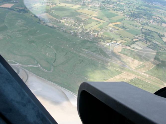
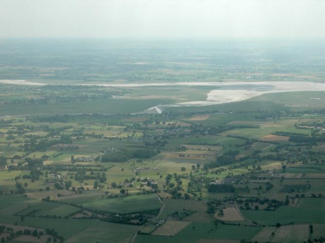
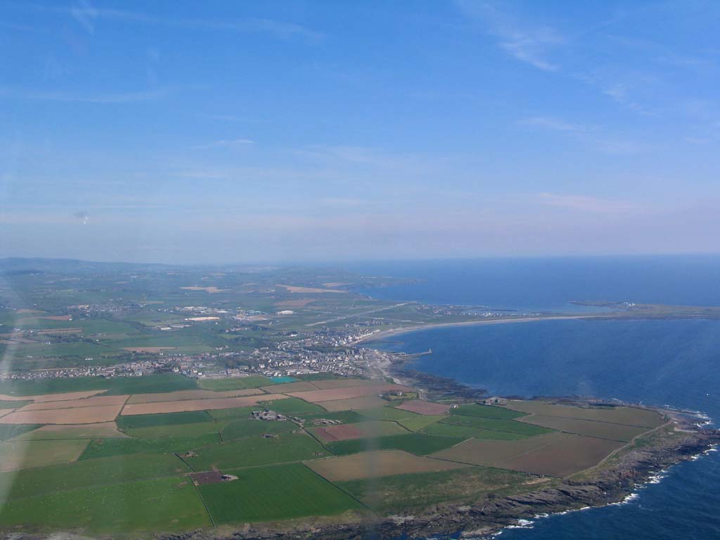
Having (eventually!) found the little grass strip of Avranches in the France VFR 'Mont St Michel' scenery, I just had to go there... (well, okay it was also the bi-annual fly in and piss-up!). Anyhow, the flying club sent a delegation of 15 people in 5 aeroplanes!
And yes, the airfield is right in the estuary, and yes it is tidal, although the runway is only flooded by spring tides.
-
Glat to hear you're still at it :) Flying cancelled because of bad weather is just a fact of life in this country (unless you go on to get an IMC rating). I had a plane booked for a 20 hour trip to Rome and back last month (3 days there, some holiday then three days back), but had to can the whole thing because I just couldn't get across the channel thanks to front anfter front after front! :(
The good weather this weekend is just throwing sand in my face - the plane is now offline! :evil:
-
You could also take a look at some of the French Altiports ( http://www.vf-air.com/club21.htm ). Okay, there's more people about than in your typical bush scene, but the mountains'll hit you just as hard, and there's nothing quite like the challenge of landing on a 10 degree upslope that you can't even see until you're on final... :)
-
Well done Laurie! :D Just wait till you land the plane yourself.... 8)
-
My Dell 17" TFT runs at 1280 x 1024 native, which scales down to 800 x 640...
Windowed evereything is in proportion, but running full screen the dials on the panel do look vertically stretched slightly. Guess what? I run windowed.
The 800 x 600 rule is not normally a problem for me (two times winner too :lol: ) since I frequently trim a bit extra off the top or bottom.
-
Excellent Laurie, good on ya! Look forward to hearing how you get on.... :) Must visit Leicester sometime. Flown over it a few times but never landed....
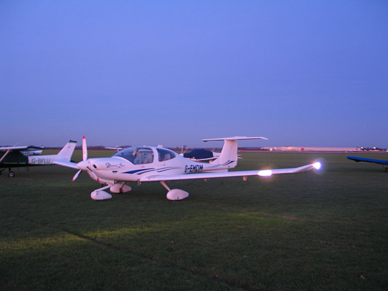
Just finished my Night Rating last week at Oxford. YAY!
-
Hi Catflyer,
I can't say too much about costs & servicing etc, as "mine" is a club aircraft and so rented. That also means it's on a "Public Category CofA", which has a much more stingent regime in terms of 50 hour checks, engine life etc. than for Private Cat aircraft.
I can tell you it's a DA40-180 with a fuel injected Lycoming engine (not the Diesel), and traditional steam gauges (RMI slaved to the compass or GPS). It cruises around 130kts at 24"/2400 for 10usgph. In common with other "plastic" aircraft, it's quite slippery and takes a while to slow down.
Using the stick is very intuitive. If you're concerned about transitioning from using a yoke, don't be - it's a complete non-event.
Compared to the 95kt Warrior I sometimes fly, it goes like stink :D
On the ground, it has a castoring nosewheel, so steering is by differential braking in the toe brakes. This may take a bit of getting used to, but I find it easier to steer than the Katana I learned on!
Downsides: I have to say the seats are not too comfortable. Not an issue on short trips, but if you're off touring, you'll feel it after a few hours. The seats are actually rigid and fixed in position (the rudder pedals can be adjusted back and forward). The bubble canopy gives great views, but take a tip: wear a baseball cap.
Hope that's helpful :)
-
Just finished another 2.2 hours of night circuits, where much of the time I couldn't land the plane for toffee! It felt like I was back in my rookie days, misjudging the flare height. Without the visual cues of the runway and ground that you would see during the day, it was quite difficult going on just the runway side lights alone, so I had some go arounds and a few bounces. :roll:
Three more solo full stop landings and about half an hour should see me finished. :D
Edit: to add the pictures :)


-
Just a thought, Lars: Do you have the v9.1 update to FS9? The original version (9.0) was prone to CTD at some locations and in certain seasons of the year. If you don't have it, it may well fix your problem. You can get it from the Microsoft Flightsim web site: http://www.microsoft.com/games/flightsinloads.asp
-
Thanks :) "Night VFR"... strictly speaking in the UK it's IFR at night, or SVFR inside CAS.
-
(Night flying is not part of the basic UK PPL syllabus: it needs to be done as an additional rating.)
We kicked off with a bit of messing around with the instruments and the lighting systems on the ground, just to get the hang of things. The DA40 has two panel lighting systems. One is the regular backlight behind each dial, the other is a blue luminous 'floodlight' located under the glare shield. Both can be adjusted via knobs on the panel. The art is to have them turned down as low as possible.
The next trick was taxying round to the hold. There are no taxiway lights at Wellesbourne (EGBW) and so it was very dark once away from the immediate glow of the tower. It is doubly important not to deviate from the yellow centre line! The glow of the taxi light is clearly focussed (unlike in FS) so that the beam illuminates the path in front of the nose. When going through the preflight check lists, it is essential to have a torch. Two are preferred, in case one fails!
Alistair handled the first take off (from 36, wind 350/14), with me following through on the controls. It wasn't so much different to normal (other than being pitch black with no frame of reference other than a string of lights either side!). The first 500 feet or so are flown with sole reference to instruments, until a viable horizon becomes visible.
The trip started off with a navex. Heading West from Wellsesbourne, we crossed Stratford and headed towards the lights of Worcester. At one point we diverted South by a couple of miles to avoid a rain shower (at 3000ft the temperature was only 1 degree C, we didn't want to tempt any icing!). It was only made visible by a blurring of the city lights! At Worcester we estimated an impromptu course towards Bristol, and headed into the darkness beyond Great Malvern at FL40. The view was spectacular - Hereford off in the distance to the right, the great snaking line of the M5 to the left, and Cheltenham and Gloucester beyond.
Time for a FREDA check. All the normal stuff - check fuel and change tanks if necessary, radios, engine Ts & Ps, direction and altitude. Delta Mike's DI is slaved to the compass, so that's one less thing to worry about (the compass is unlit!), and we're above the the transition altitude so the main altimiter is set to 1013. One new check: shine the torch up and down the wings, just to check that there's no ice forming!
Way in the distance, we can see what must be Bristol. We dialled in their NDB, but again unlike FS,it was completely useless at this range, the needle just hunting around seemingly aimlessly. Eventually we saw two red-lit towers in the distance - the Severn Bridge. We were now in range of Bristol LARS and so called them up for a RIS. We followed the course of the river, over the two bridges towards Newport, where we turned inland to retrace our steps. Bristol asked our intentions vis-a-vis altitude, as they had an inbound on radar letdown to the ILS. We requested a climb to FL50 for the trip back. It was interesting overhearing the other aircraft getting vectors. Time for some RNAV. We tuned in Gloucester's NDB. Too far away of course, but we estimated a course towards it (aided in no small way by the city lights!). Once we had the signal we homed in on it, and before long were overhead. They weren't actually open, and a completely unlit airfield at night is as pitch black as any other unlit field!
By now we were reaching the edge of Bristol's Radar coverage, so we reset the squawk to 7000, and made a freecall to Brize Radar. They gave us a new squawk code, and we requested a descent to 3000ft on the regional QNH.
From Gloucester we tracked the HON VOR until 20DME, when we headed back towards Wellesbourne. We called up the tower and requested an overhead join. They gave us their QFE and we descended to 2000 ft on that setting. By now I'm used to the procedure - turn the lights up enough to read the altimeter subscale, anjust and dim the lights again. Leaving the lights turne up spoils your night vision. Now an interesting new task: Spot the airfield. By deduction, it's on the Western edge of Wellesbourne town, which is 5m east of Stratford. There's Stratford... there's Wellesbourne, so the airfield must be in that black patch. Oh...kay... A red light catches my eye, and I point it out, thinking maybe it's one of the runway lights. "Watch it" says Alistair, and momentarily it changes, yellow... green... Oops! Traffic lights! :oops: We're almost in the overhead by the time a linear feature of lights becomes obvious: the runway (not even the green flashing beacon on top of the tower stands out from the other distractions)!
Once overhead, Alistair takes control again, and demonstrates the first circuit and landing. Runway 36 left-land is still active. The circuit itself is surprisingly easy to fly, since rather than looking for tenuous landmarks to define it - 'interesting' corners to fields etc, the pattern of lights on the ground makes it more or less obvious (its also easy to spot the villages not to be overflown!). Again, as for a normal circuit, fly downwind with the runway on the wingtip. Final approach is a matter of keeping the runway lined up ('string of pearls' profile with the edge lights, there isn't a lit centre line at Wellesbourne), and one red, one white on the PAPI. Over the threshold, there's no sense of the approaching runway, since you just can't see it: just the row of white lights either side. Aim for the row of red lights at the far end, and as the edge lights approach your elbows, flare! The landing light is demonstrably of no help: it's only practical benefit seems to me in showing other traffic that you're there. Interesting.
Now my turn....! The wind by now has changed to 330/17, and it's a little frisky at circuit height. However, the approaches are at least reasonable. I do find the flare hight somewhat difficult to judge, with a tendancy to flare late rather than early, and not enough rudder on the take off pushes me well towards the left of the runway. I also notice I'd forgotten to push the prop lever fully forward. Next attempt better, but possibly not the best idea taking off on full flaps! 3rd landing was very flat - almost didn't flare at all, 4th was okay as was the 5th and final. That just had me wandering off the centre line a bit as I slowed down.
A cluster of blueish lights is the only reall indication of the exit to thee taxiway, and again the importance of maintaining the centre line becomes clear: There's a yellow painted feeder line indicating the turn off, but it's hard to make out in the poor light, even with the taxi light on. Too fast or away from the centre and you'd miss it. Once clear of the runway, essentials (including strobes and landing light) off, and head round towards parking. 2.6 hours in the dark! Next session: emergencies and solo....
:-) Tim
-
And also there's the AAIB here in the UK: http://www.aaib.dft.gov.uk
-
The Cub is default, Bill Lyons did a rather nice Luscombe (freeware on Avsim), there's a couple of Aeroncas also on Avsim....
-
I simply don't have the space for a CRT, so TFT does for me every time. I have a Dell 17", which connects to my 'gaming' PC via the DVI interface and my 'non-gaming' PC via the analogue. Rock-solid imnage for both, and never suffered from the 'shimmer' effect.
-
That's like saying If I have black & white TV, do I really need colour? What it adds is depth and intensity, and of course community, with freebies like Misty Moorings.
UT is a step change above the default. Misty is a step change above UT. It's all in the detail. :wink:
-
After reading this thread, I've just got a copy (£16.45 inc p&p from Cordee, as above; postie delivered it this morning :D ) and WOW! that's one seriously nice atlas! Can't imagine I'll get much done today! :lol:
The only suggestion I'd make for the next edition is: make it spiral bound, so it lays flat easily. :lol:
-
Hi Holger,
Thanks for the summary :)
Judging by the photos elsewhere, you obviously had a good time in the woods! 8)
-
Thanks Francois, I hope you are having a nice holiday :D Not sure I want to know what Holger is doing in the woods... :wink: :lol:
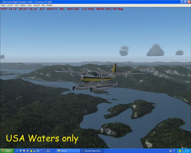
I've been in touch with Raimondo at FSFreeware and it seems there's not a straightforward correlation between his files and the Misty coverage area. The simplest thing to do therefore is just to disable USA Roads/Waters from the addon scenery dialog when flying in Alaska. It means restarting FS, but given the number of times it crashes anyway, that's no big deal. :roll:
Regarding the publicity, I think I clicked on the wrong link and then didn't notice I had the CD option selected instead of the download -- until it was too late :roll: Mea culpa! Still, the map is nice (although I'd rather spend $5 on a full size sectional than a magnifier...)
Cheers
Tim
-
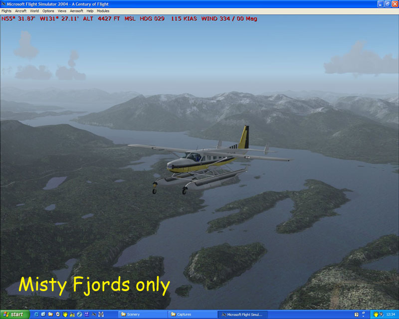
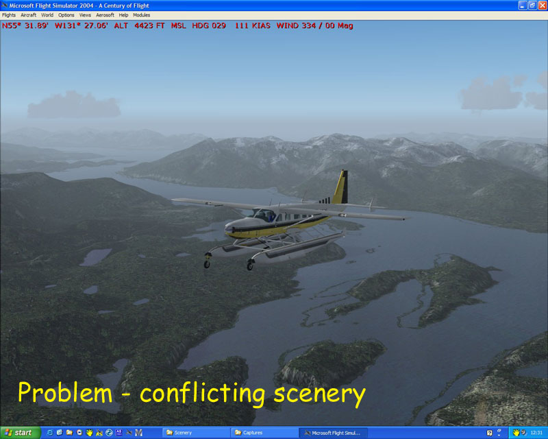
Good thought, Spook, but not that.
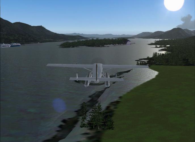
I believe I've tracked it down to a conflict between Misty Fjords and FSFreeware's USA Waters/USA Roads packages. The attached screenshots show the effect of switching each package on or off. As is evident, the Misty scenery is much more detailed.
Presumably removing the files that overlap from the FSF directory will sort the problem without having to disable it each time. Has anyone done/tried this?


-
Always one to grab a bargain :wink: I saw the 4th July offer, and thought "hey...". Of course I didn't read the small print well enough and ended up with the undiscounted CD :roll: (but that's my stupidity!)
Anyhow I've installed it now and taken the first flight... but there appears to be something missing between the coastline and the land! Any ideas? Is this something I've missed? I have TERRAIN_MAX_VERTEX_LEVEL set at 21, in case that makes a difference.
Thanks.
T.

-
Well done Claude :D I'm sure many people have already told you, what you have gained is a licence to learn :lol: I passed my test in March and it still seems like yesterday!
Be safe, and happy flying
-
My initial planning for an FS flight is exactly the same as for a real one (although I tend to use M$ Encarta Atlas for parts of the world where I don't have charts). Then in FS, I set up the departure and destination airports, and define a GPS direct flight plan which I then drag and drop any additional waypoints into (I tend to include a lot of NDBs which FS won't do automatically). Inside the flight, I don't normally bother with an external walk-round, but I have a saved 'cold start' which I invariably use, going through the normal checks, as in RW. In flight I also do periodic FREDA and other checks, and the before landing checks etc. I'm paranoid that if I start to get sloppy in FS, I'll also get sloppy with my real flying!
-
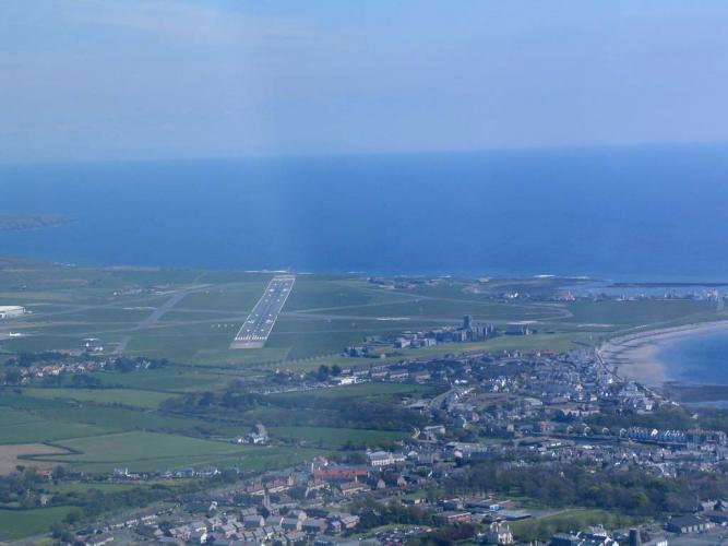
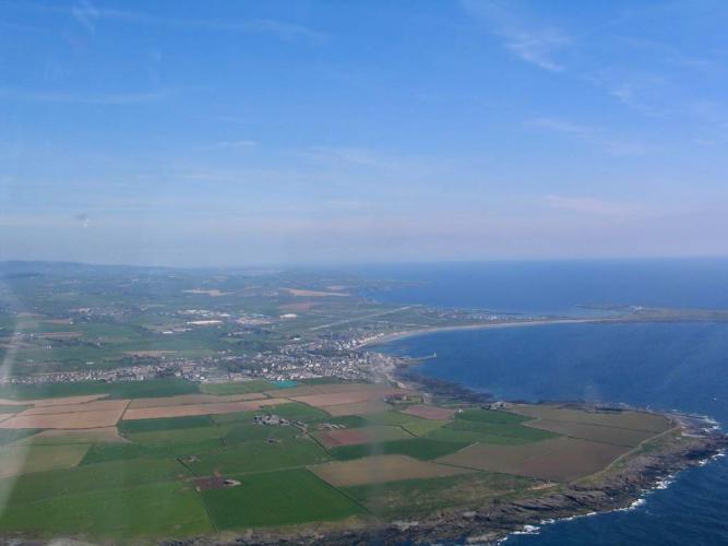
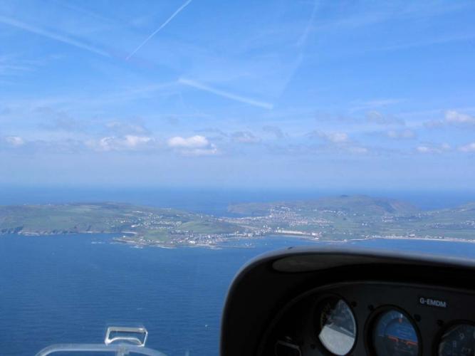
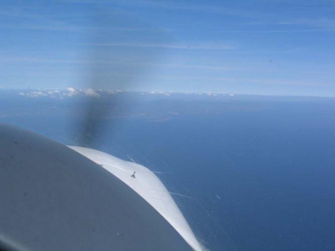
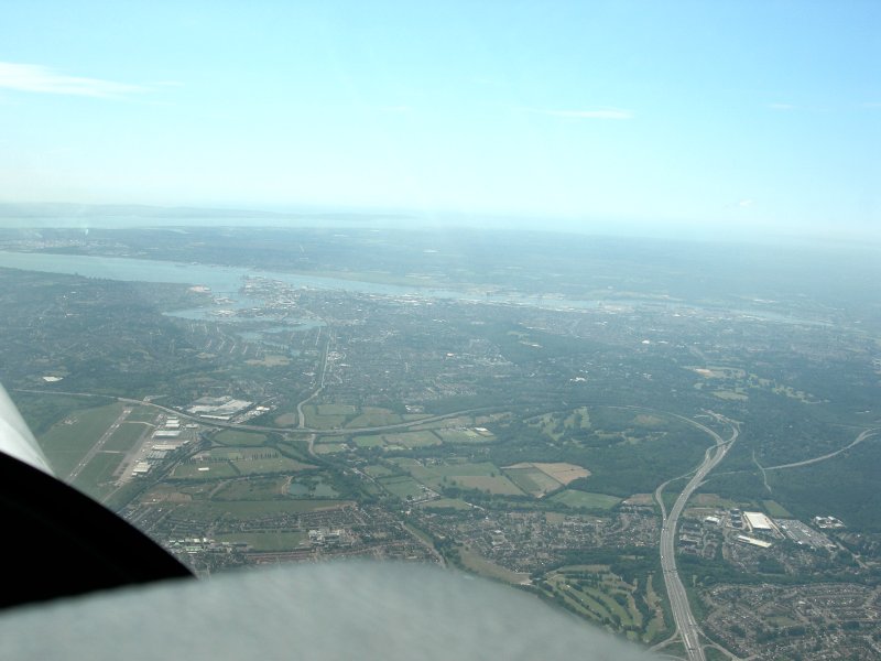
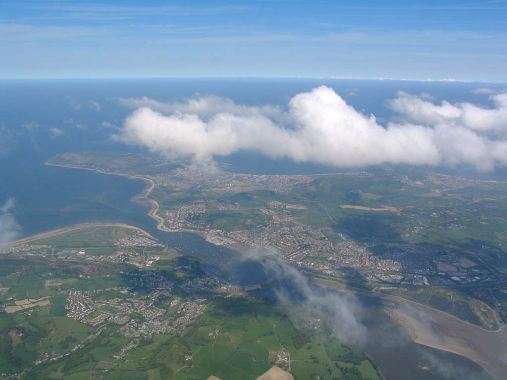
I did part of my DA40 (Diamond Star, big brother to the Katana) check out yesterday. This was on a club fly out to Ronaldsway (EGNS) on the Isle of Man. For those that don't know, the Isle of Man is a 30nm long island in the Irish Sea, about midway between England and Ireland. The trip was 186nm each way, and I was RHS passenger flying out, and pilot flying back. I still need to do some stalls and circuits before I'm fully signed off, but this was a good 1.7 hour flight.
Anyhow, here are some "screenshots" with a few comments :)

-
Also EADS Socata makes the TB range of GA aircraft (TB9 Tampico, TB10 Tobago, TB20 Trinidad, TB200 GT, TBM700 Turboprop etc). Most of these are available for FS...


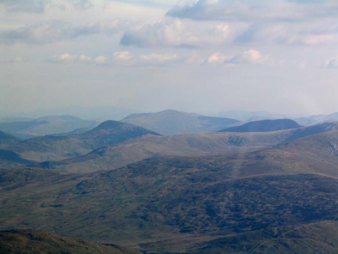
Avranches
in Real Aviation meets Simulation
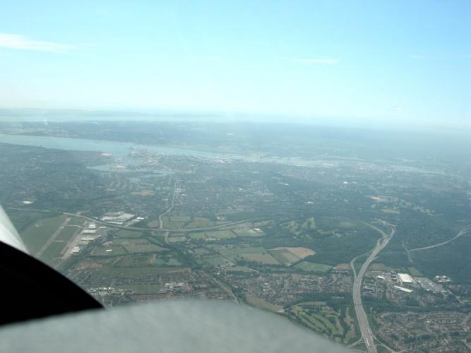
Posted
The following day (remember, eight hours bottle to throttle!), was not so nice. Visibility was still around 10K when we took off, but we soon discovered the cloudbase down to around 1200ft... er, 1000ft... er, 800ft..., er 600ft... Ulp! The AIP says Sea Fog can roll in very quickly and with no warning. Well they weren't kidding! Never before have I called "Left base, 500ft, not visual with the runway" (and hope never to again). But then there it was, and I was high, so full left boot and lots of right aileron in order to slip it in - I really didn't fancy having to go around and lose sight of the field again!
On the ground there was nothing for it but to go into town and book a hotel.
The next day dawned... foggy again. Ho hum. Now Customs had also departed, so we'd need to stop at a customs airport on the way. Cherbourg was the obvious choice, but also completely fog bound. As was Dinard, but with thunder storms into the bargain. Around lunchtime it cleared sufficient for us to make a dash East - Le Havre. Here we could clear customs, but now the English coast was fogged in, so... another town, another hotel!
Tuesday. Now not foggy, just misty. On the positive side, the UK coast was clear, but here in France it was a waiting game to see if the mist would lift enough before the afternoon thunder storms were due... 12:30 we decided to go for it. The mist only gave us about 5km visibility, and the cloudbase kept us below 1300ft, and the crossing to Goodwood (GWC VOR) was 90nm, including a diversion around an active Danger Area. Ho hum. Then about 20 miles from the English coast, we were suddenly in clear air, clouds at least 5000ft above us! That didn't last long though, and on coasting in we were back down to 1900ft. But at least we're home!